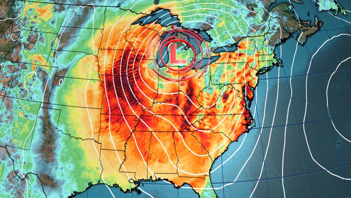
An unusually powerful March storm is trekking across the country with a wide range of hazards from strong winds that could set off blizzard conditions and dust storms to severe thunderstorms that could produce tornadoes.
The disruptive storm was building over the Rockies early Monday but will strengthen and expand over much of the central US by Tuesday morning, firing up severe thunderstorms on its southern side and wintry weather to its north.
It’s the first big test for the National Oceanic and Atmospheric Administration and its National Weather Service that’s staffing was slashed by the Trump administration – cuts scientists say will have dangerous consequences for the safety of the American public. Around 800 employees were laid off across NOAA last week.
The storm will get even stronger from there, and could reach “near record strength for March” as it tracks east through the eastern half of the US Wednesday and into Thursday, according to the Weather Prediction Center.
Here’s what to expect each day:
Monday: Strong winds, thunderstorms begin
Wind speeds will increase Monday – especially from the afternoon on – in the Rockies and parts of the Plains. These winds could reach 60 mph and be potent enough to knock out power or cause localized damage on their own, but other risks will escalate alongside them.
A level 3 of 3 extremely critical fire weather risk is in place in parts of eastern New Mexico and western Texas as winds blow over very dry land, according to the Storm Prediction Center.
Any spark could quickly turn into a rapidly spreading inferno in these conditions.
Texas Gov. Greg Abbott has directed state emergency personnel to prepare for the possible double whammy of critical fire risk and severe storms. Several state agencies are on standby and have prepared to deploy firefighting and storm rescue teams, including more than 200 firefighting personnel, National Guard helicopters, rescue boats, and additional ambulances and medics, the governor’s office said.
Strong winds and dry land will also combine to create areas of blowing dust that could make it difficult to see and travel hazardous, according to the National Weather Service in Albuquerque, New Mexico.
A dangerous dust storm in southern New Mexico shut down at least two interstates in the area after it began late in the morning. Video from a truck driver on Interstate 10 on Monday shows a multi-vehicle crash amid a hazy dust storm near the city of Deming.
Thunderstorms will roar to life in the evening and overnight from Texas to Kansas. These storms will start a prolonged, widespread threat for damaging wind gusts, hail and tornadoes over the southern US.
Powerful wind gusts and hail will be the main threats when storms first form late Monday, but the tornado threat will increase overnight while individual storms start to congeal into an expansive line.


Discussion about this post